

Meteorological analysis of the two exceptional storm surges that hit the Ligurian Sea on Wednesday 20th and Friday 22nd. “In 35 years of surfing, never seen such big and surfable waves in Levanto” – Gabriele Raso
Text by Michele Cicoria | Photo by Giovanni Lapucci @giovanni.9.6
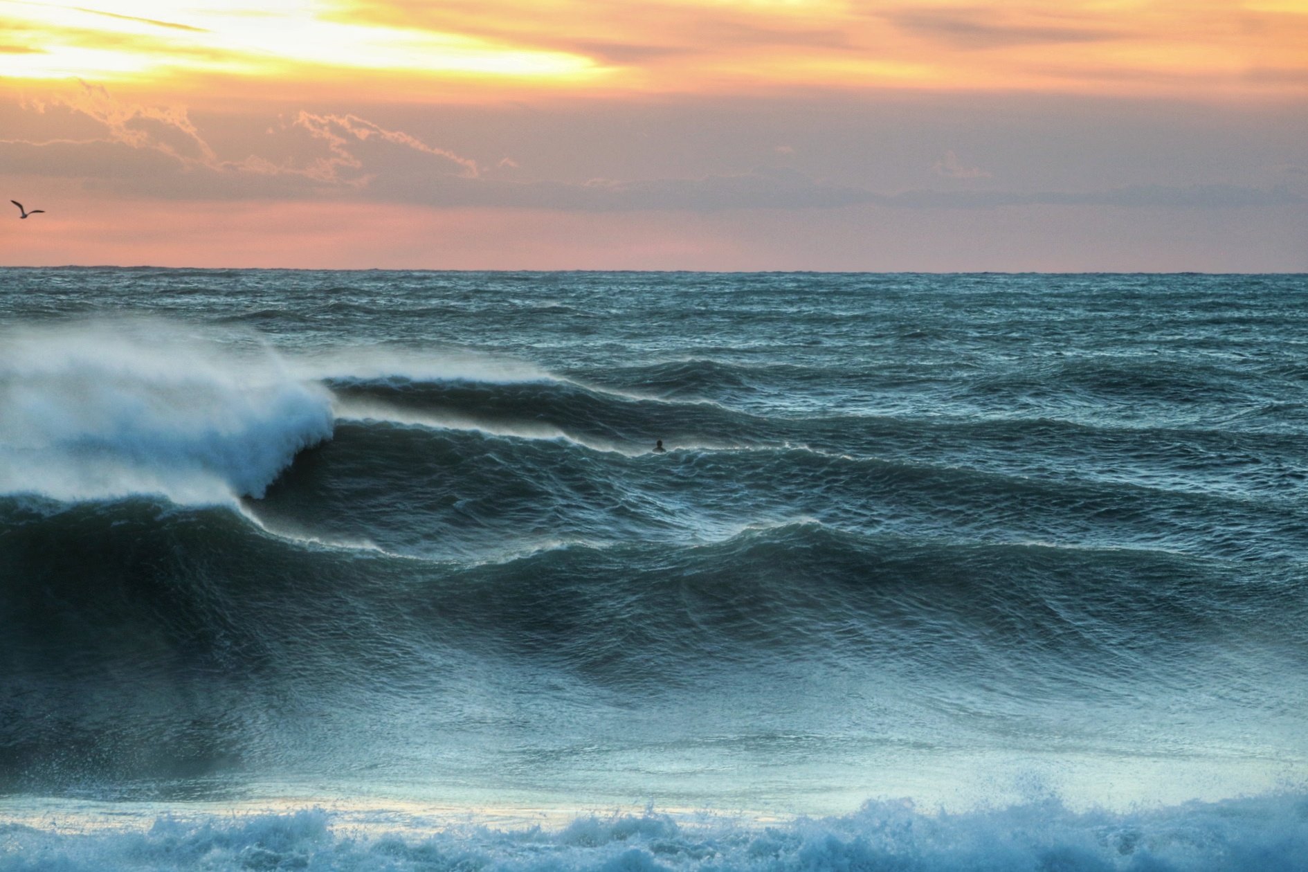
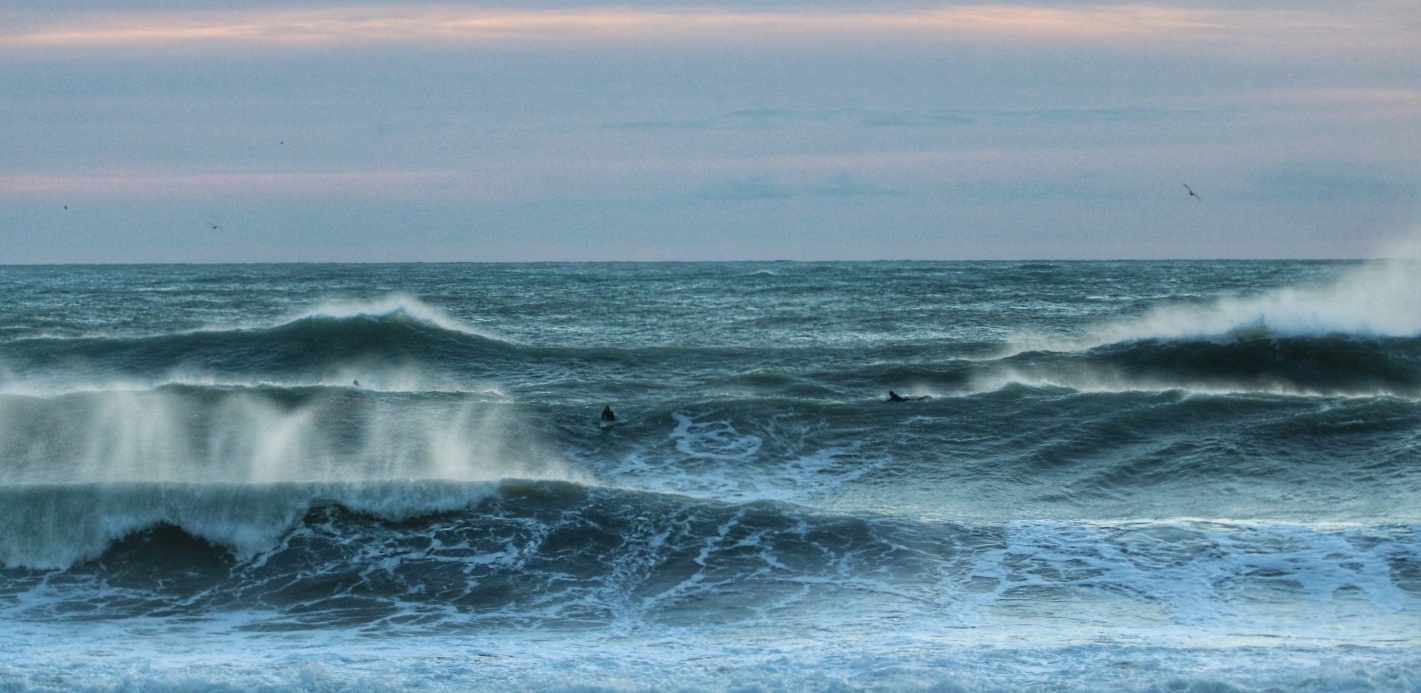
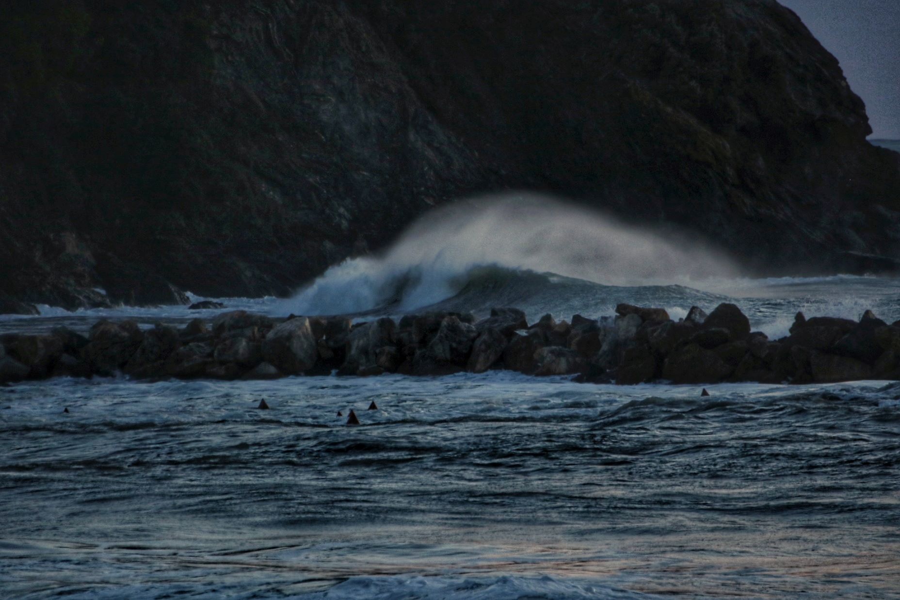
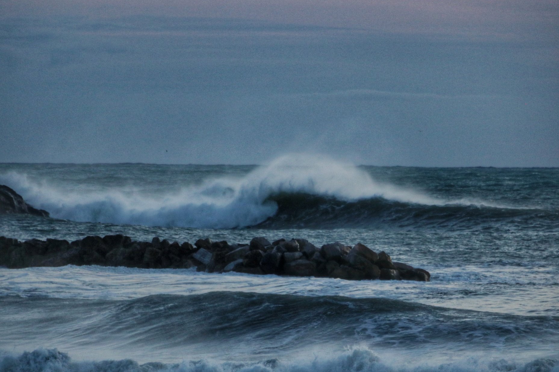
When all the meteorological ingredients coincide perfectly, there is no need for an ocean fetch, nor the potential 1200 km that the western Mediterranean can offer. All it takes is a huge swell of short south-westerly wind that meets the right amount of onshore wind, to produce waves that according to Gabo, a historic Levante surfer, with some sets have reached 7 surfable meters.
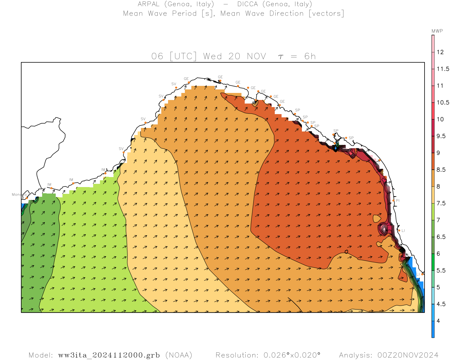
This is what happened on Wednesday 20 November, when a cold depression of Arctic origin quickly pushed towards northern Italy, activating very strong “short” south-westerly winds with a fetch of less than 350 km, which starting from Provence reached the Ligurian coast with average speeds at certain times close to 90 km/h.

24 hours of wind were enough to generate waves almost 8 meters high offshore
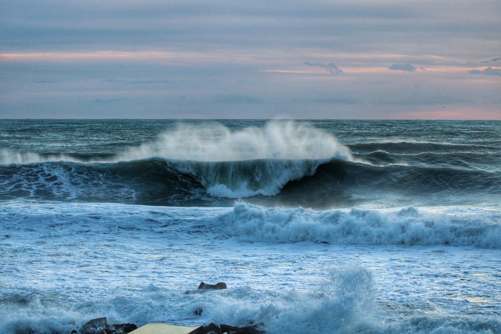
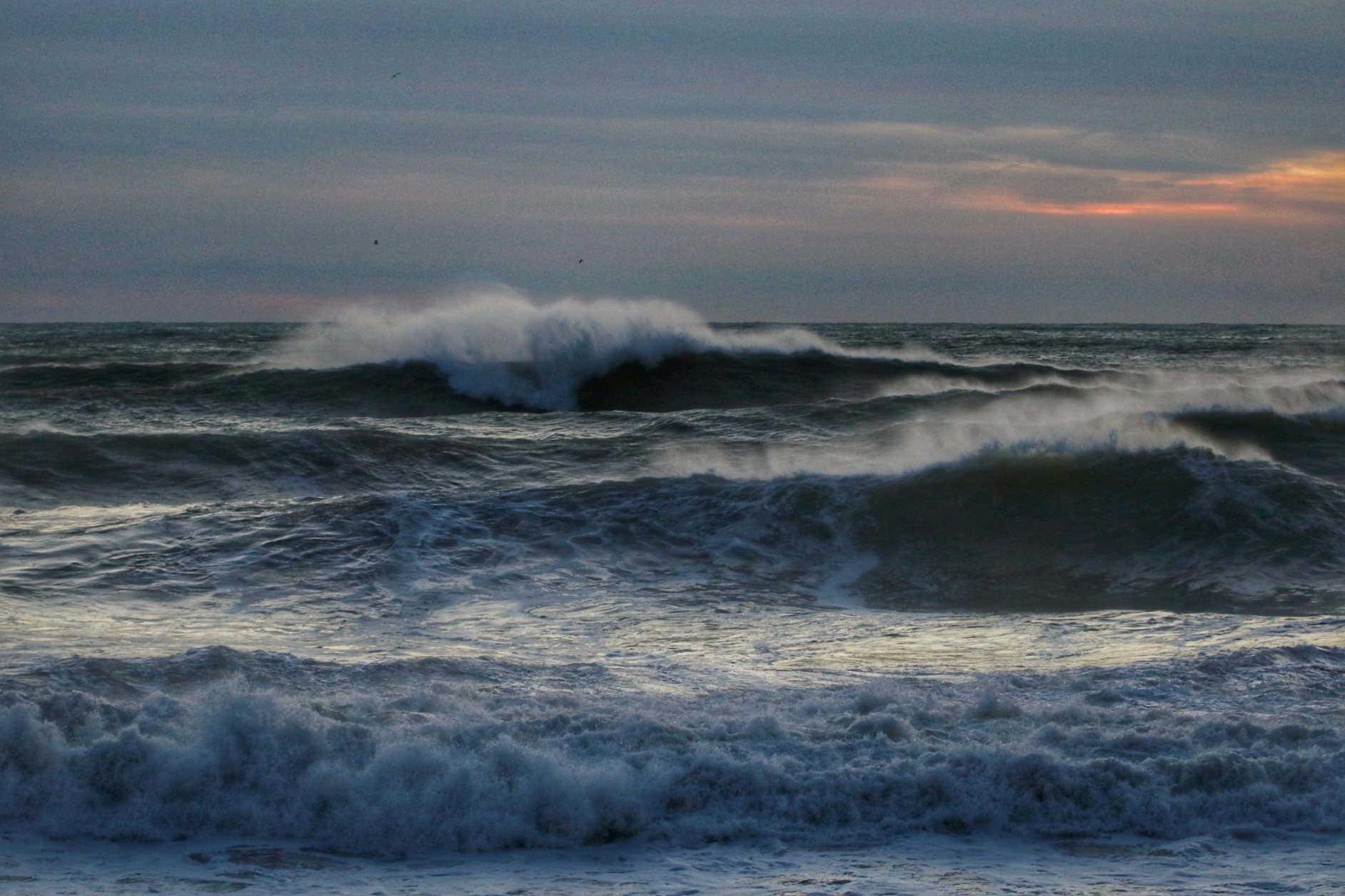
The national wave network, unfortunately, is almost dead and most of its buoys are currently out of use, including the very useful one in La Spezia. But the equally fundamental buoy of Gorgona, off the coast of Livorno and managed by the Functional Centre of the Tuscany region, is still in use and last Wednesday recorded, shortly after 6 in the morning, a peak in wave height of over 7.5 m, close to 8 m. The second peak was then reached in the early hours of Friday 22, when a second storm surge hit the Ligurian coast, particularly affecting the Levante.

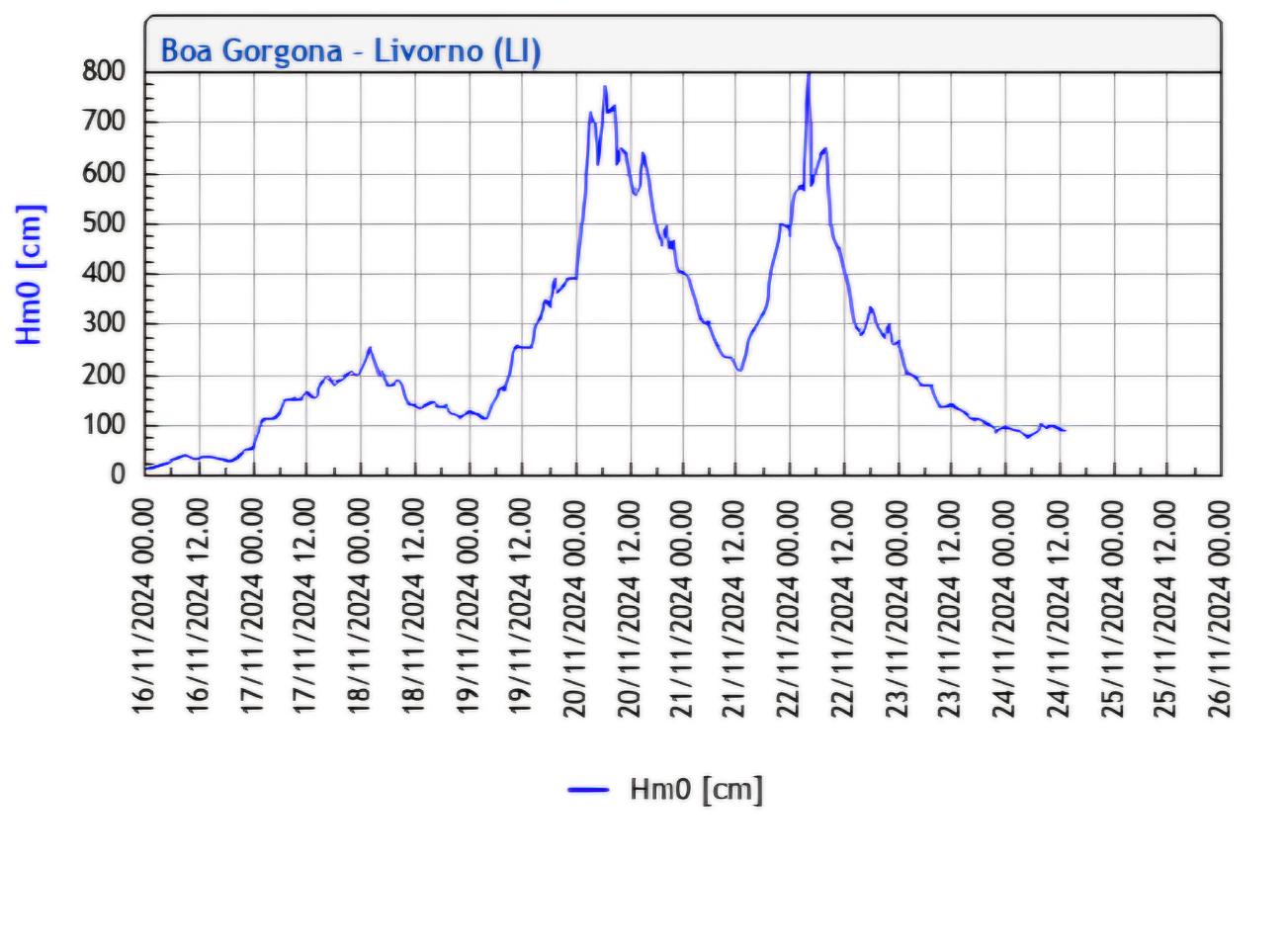
Similar values have not been recorded for over a year, since November 3, 2023 to be exact, when the famous “Ciaran Storm” [read the article here] brought the same buoy of Gorgona to almost touch the 7 m of wave height without reaching them however (image above, on the right). One meter less therefore, for a storm that given its direction, as you can see in the article, brought the best waves to western Liguria, while the eastern one often found itself under the effects of an active storm due to the strong onshore winds.
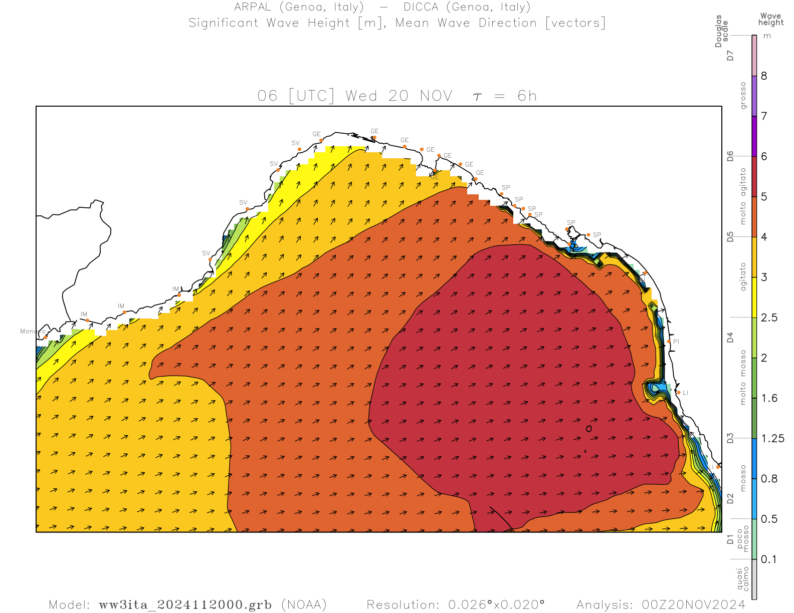
What happened on Wednesday, November 20, 2024
The Arctic disturbance was so fast in crossing central-northern Italy that it brought a sudden change in the direction and intensity of the wind, which favored the transition from huge and unsurfable waves to increasingly huge waves but increasingly smoother, combed, slowed down and at the same time raised by strong winds from the land along the eastern Ligurian coast. What has been said can be observed from the wind forecast maps offered by the European meteorological model ECMWF. The first, on the left, refers to 7:00 local time on Wednesday morning, when the south-west wind was in full swell loading phase, while the second refers to the evening, when the north wind had already crossed from the Po Valley towards Liguria offering a perfect combing of the wave motion, to say the least enormous.
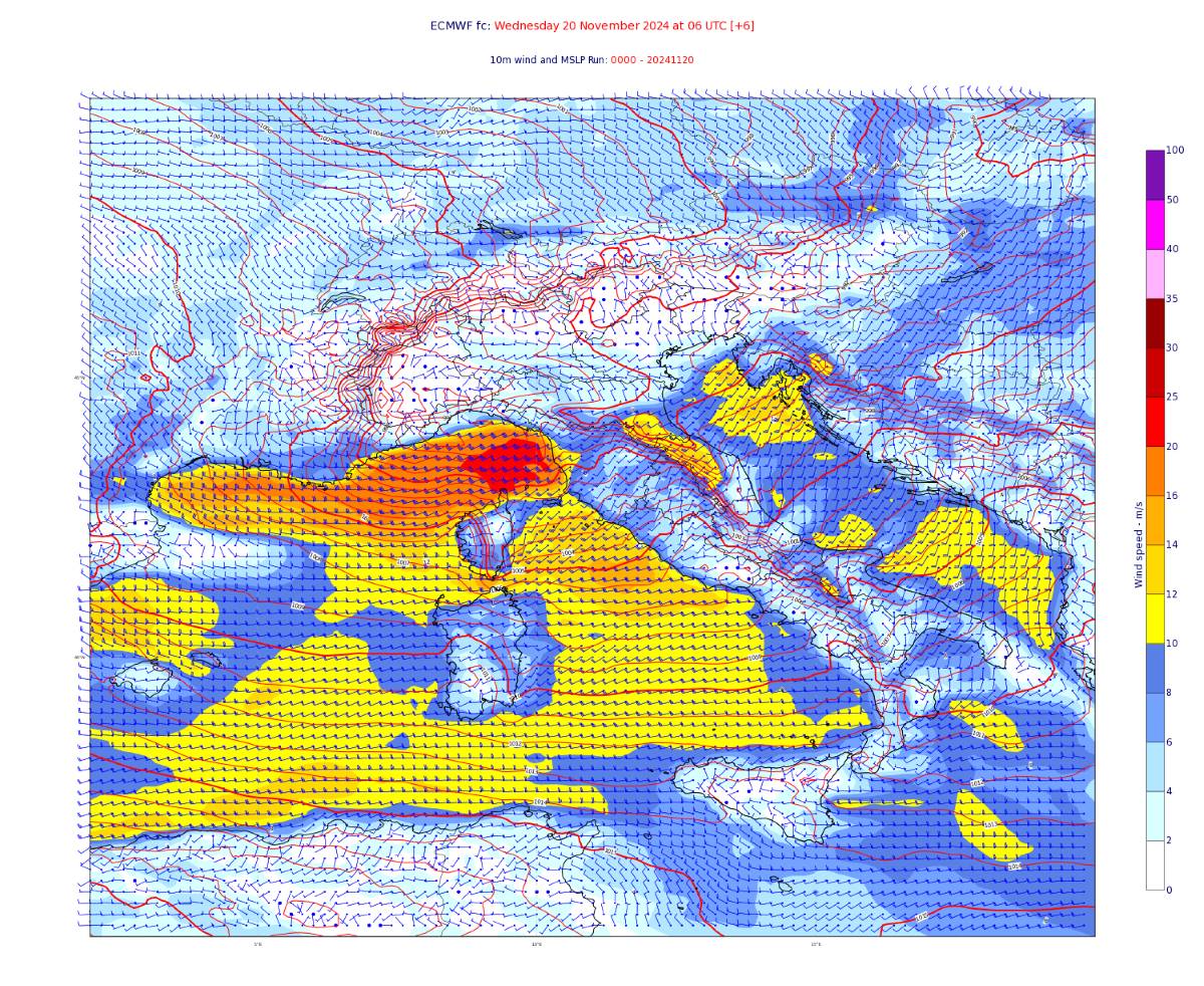
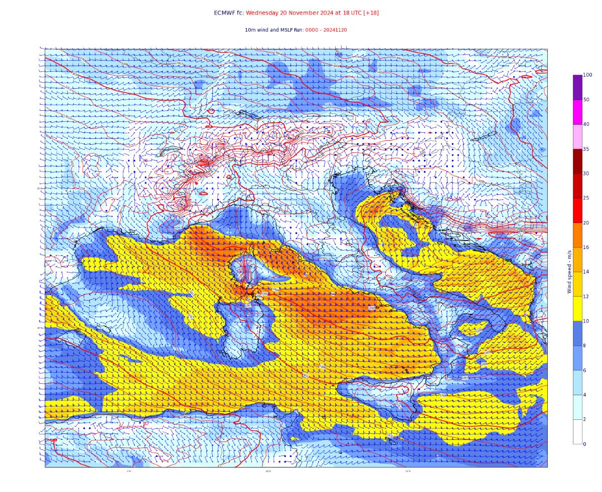
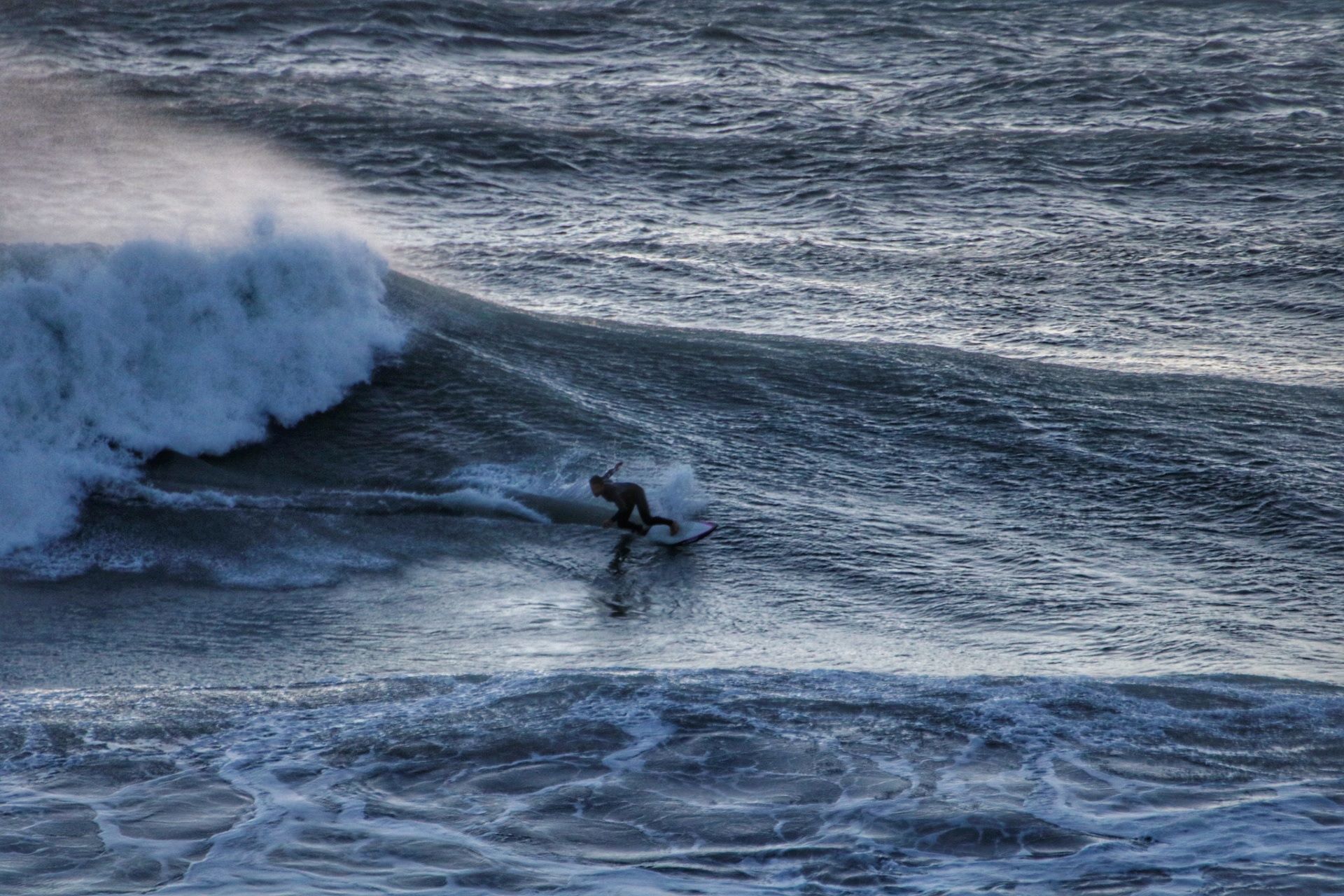
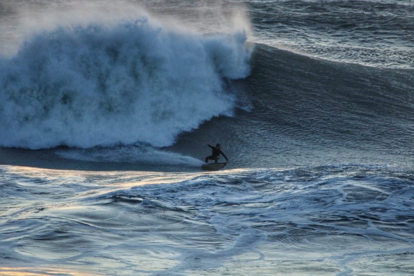
In these two images, the position of Liguria and the respective winds at sea must be identified: in the image on the right, the areas in red indicate where the south-westerly wind blew at an average of 90 km/h for a few hours, in the one on the right, the direction of the wind vector is clearly visible, arranged from the north in the areas in blue, and with a decidedly more moderate intensity. The result of this recipe with perfect ingredients can be seen in the photos by Giovanni Lapucci (@giovanni.9.6 ) in this article. But before leaving you with his more than representative shots, I leave you with the words of Gabriele “Gabo” Raso (@gaboraso), a historic surfer from Levanto who, when I asked “Oh Gabo, is it true that you’ve never seen anything like this?”, replied:
“Hi Miky, I tell you, in 35 years of surfing I have never seen anything like it. I mean, I repeat: it has had giant swells, but those that produced waves of that size, surfable and so perfect, never seen before. I mean, it was something out of the ordinary. Ironically, the sets that Giovanni (Evangelisti) and Federico (Nesti) took, which were still giant, we are talking about about 5 meters of waves, were not the big sets. The biggest sets broke much further out, I would say 800 m or 1 km from the shore, so on Wednesday I think the sea produced surfable waves of 7-8 meters, but then some of 5-6 meters were surfed. I went out at 4 pm, I slipped into the Pietra area, where it is sheltered, and there were more than 4 meters, that is, the wave went over the dam without even seeing it, and the dam is 3 and a half meters high. A swell like that with I have never seen a combination of elements like this. From 3:30 onwards the wind changed to the north, the sea was double what it was before. The guys were all shocked. Well, let’s hope he does another one before another 35 years! :)”
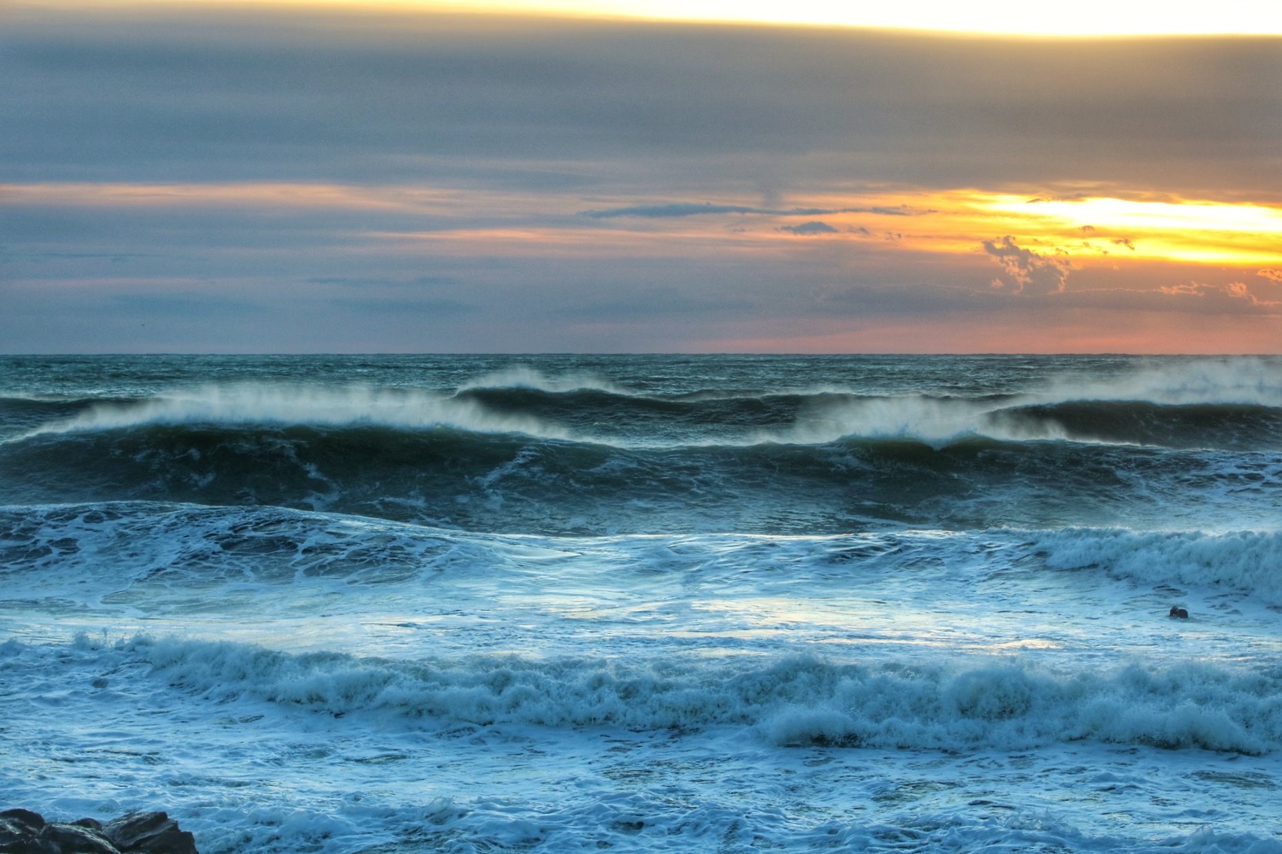
Friday 22 november
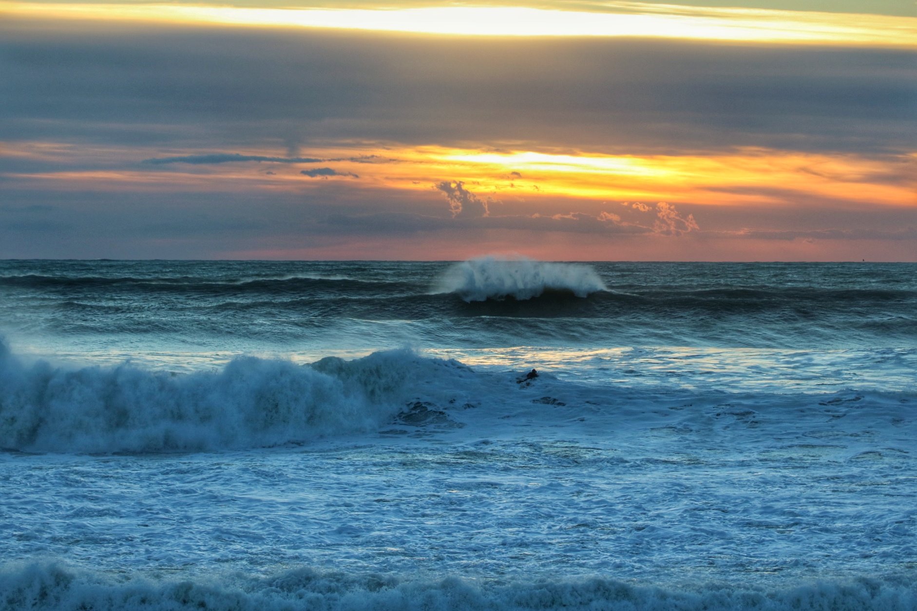
Friday 22nd the situation was repeated but with some differences, despite the Gorgona buoy having reached a peak even higher than that of Wednesday (very close to 8 m high). While the measurement was considerable out at sea, the wind from the shore near the coast came in less suddenly, discontinuously, and in a more concrete way in the western Ligurian areas. In Levanto the sea improved later, offering smooth waves only when the measurement had dropped a little more than on Wednesday. Let’s be clear, even on Friday the waves were enormous, but the record for surfable measurement belongs to Wednesday 20th November, which quite naturally allows itself to be called “a lion’s Wednesday”.