

For me, Do, and Daniele, Monte Baldo is the backdrop from which we watch the sun rise every morning. It’s a giant lying on the eastern shore of our lake, tanning in the afternoon light. It’s the sign that, when its peaks are covered in snow, winter has arrived. Why not turn Monte Baldo into a summer adventure, hiking its entire length from south to north? That’s what we did.
4Outdoor is also on Whatsapp. Just click here to subscribe to the channel and stay up to date.
Monte Baldo high route, the project is taking shape.
Towards the end of last winter, the idea of a multi-day trek began to swirl in my head, an adventure to be shared with friends, connecting two points on a map, relying on our own strength. Then that idea transformed into a dream and began to develop into a search for a possible route in the Alps, one that would capture my imagination.
And yet it had always been there, right before my eyes, how come I hadn’t thought about it before.
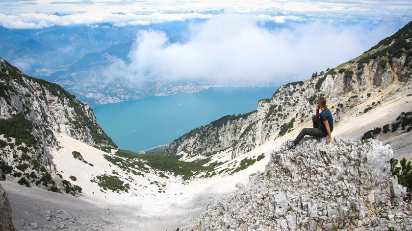
The Monte Baldo high route is a trail that runs along the crest of the massif for about 40 km between Veneto and Trentino, touching several peaks, up to the 2,218-meter Cima Valdritta. Its imposing ridge separates Lake Garda to the west from Val Lagarina (the valley through which the Adige River flows) to the east, and descends southward to the Caprino plain in the Verona area. We would set out from the south, from Prada, and arrive north three days later, more precisely in Torbole.
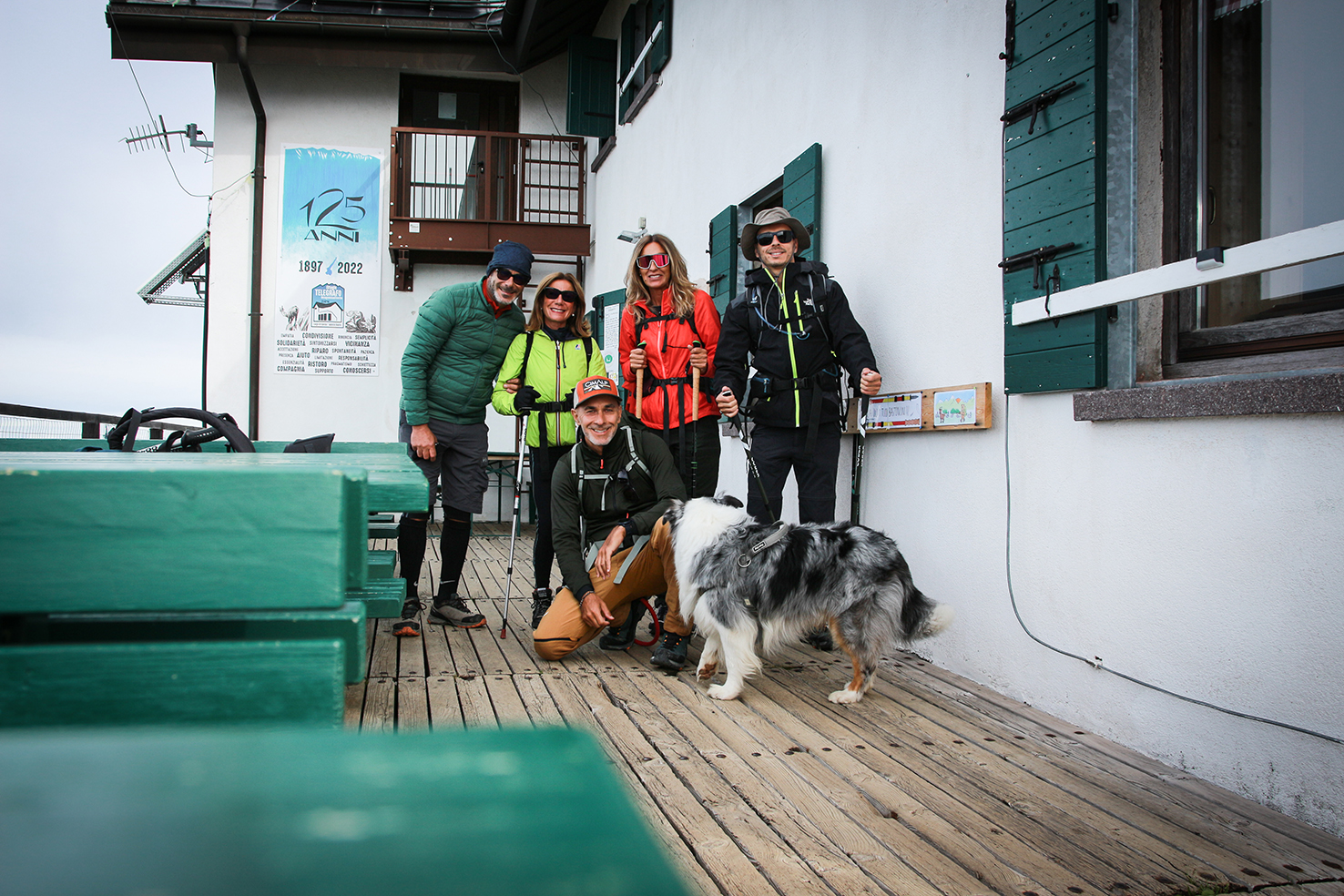
In the days leading up to our departure, Debora and her partner Stefano joined Do (my girlfriend) and Daniele (our neighbor). There would have been five of us, or rather six, with our faithful Australian Shepherd Roger.
Finally, in the last week of July, it stopped raining and the weather forecast, starting on August 3rd, announced stable high pressure.
We’d all promised ourselves we’d rationalize our loads, but three days of trekking at medium-high altitudes required changes of clothes, extra layers, sleeping bags, water reserves, food… in short, we’d enjoy crossing the lake by ferry from Maderno to Torri del Benaco and the drive up to Prada, as our last moments of peace, then we’d strap on our backpacks and it would be… stormy.
Day One: From Prada Alta to the Telegrafo Refuge
The trail from Prada begins near the cableway di Prada Costabella, starting off quite steep and in the woods and to get off to a good start we take the wrong turn, taking a kilometre of useless road.
Just above the little church of Madonna della Neve, the forest begins to open up and, although the sky is a little cloudy, we begin to glimpse the lake below us. Then the path crosses the ridge and, after passing the former Forte di Naole, we put down our backpacks and stop for lunch.
The fort was built by the Italians in 1913 to defend themselves from a possible Austrian attack and was connected by a mule track to the hamlet of Lumini.
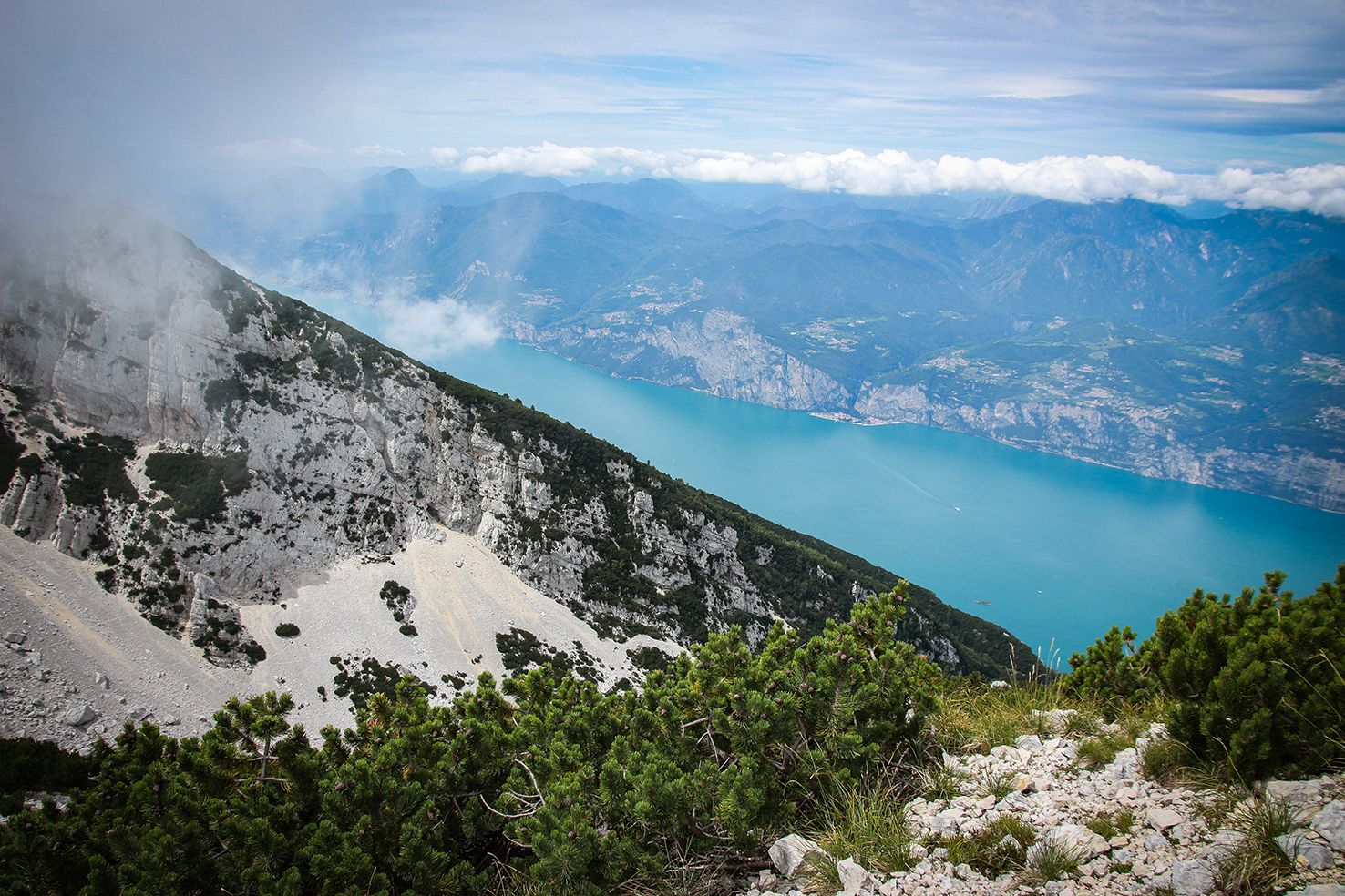
At our current altitude of 1,680 meters, it’s chilly, and as we seek shelter behind some rocks, we toast with a bottle of Dolomiti Rosso that Daniele had carried. Once we set off again, the trail once again crosses the western slope of the ridge and begins to follow its edge, offering a beautiful view of the lake. About an hour later, we reach the Fiori del Baldo refuge and, 200 meters above it, the Chierego refuge.
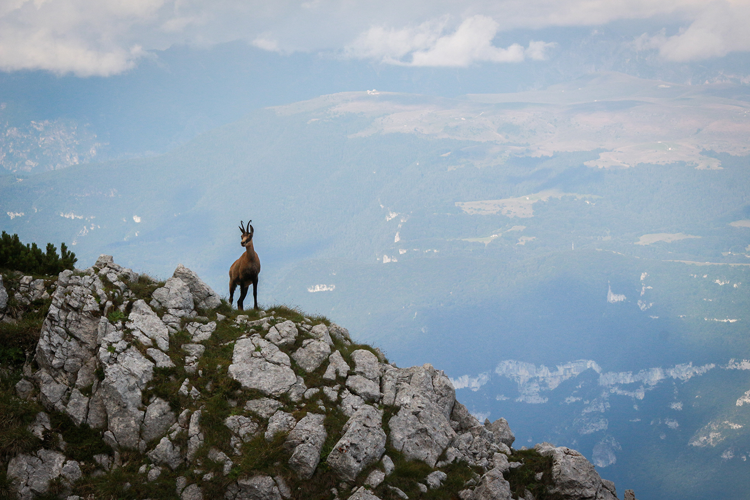
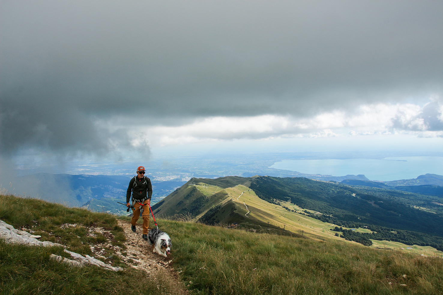
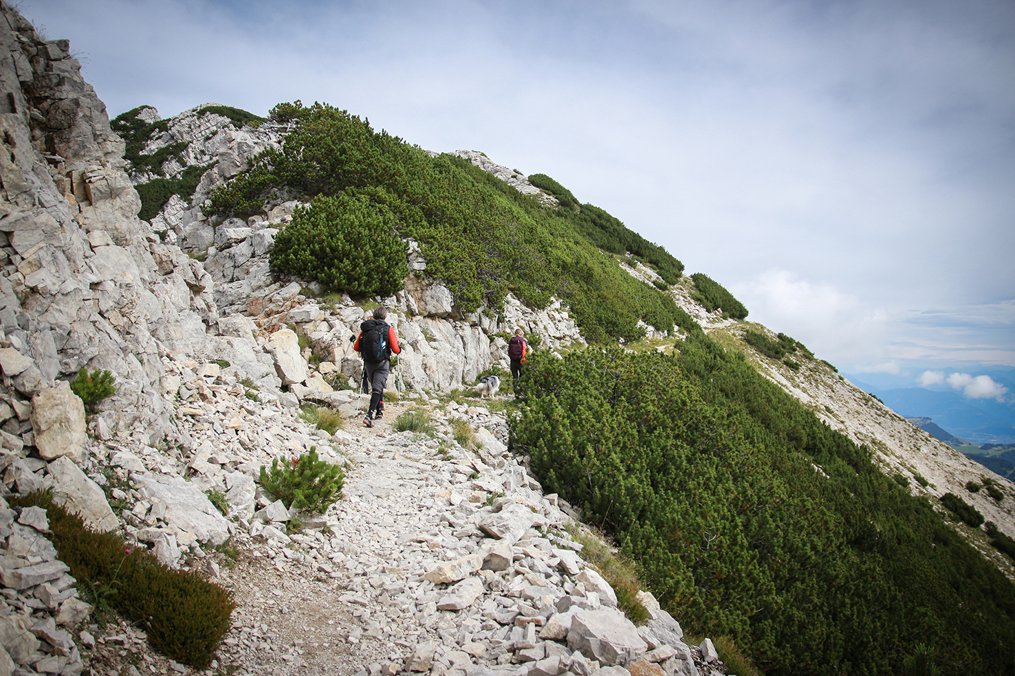
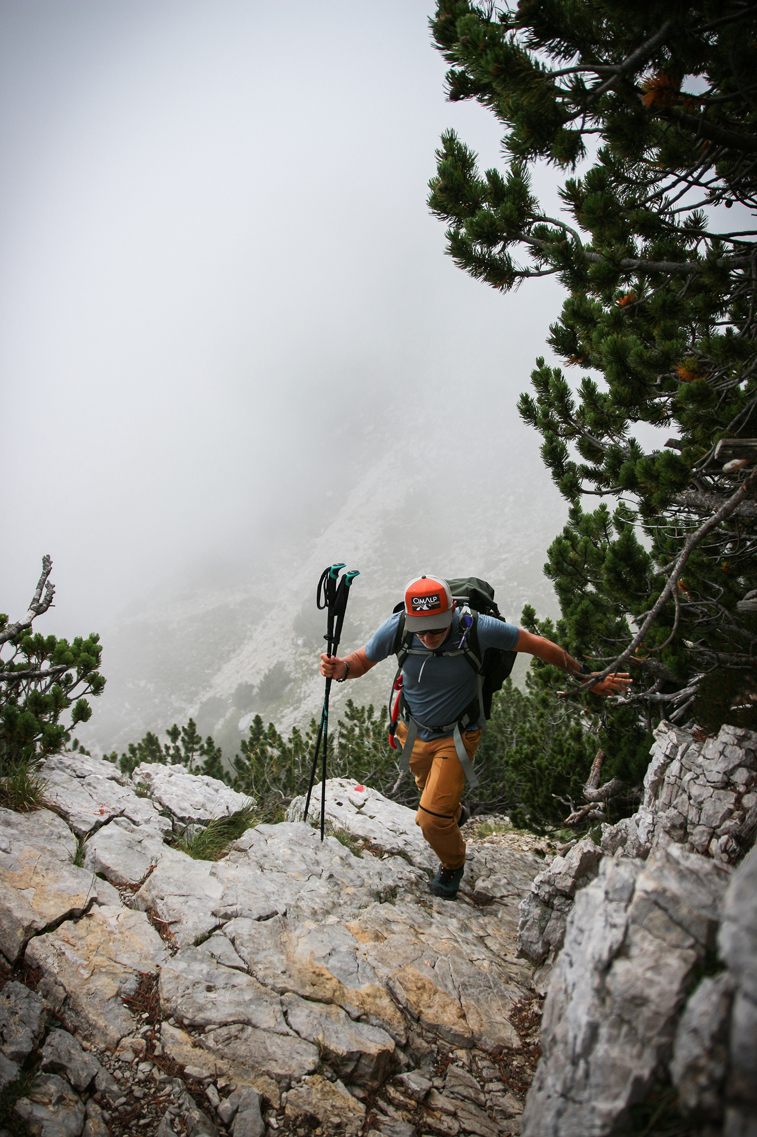
We make another stop just beyond this last one, at 1,950 meters. The clouds here touch the mountain, and at times we glimpse the panorama that extends southward to Peschiera del Garda. “Quiet!” Daniele orders, and turning, we spot a group of chamois grazing in the grass through the fog: they will be just the first of many herds we will encounter in the coming days, discreet but sociable travel companions that Roger will watch with great curiosity. Past Cima Costabella, the trail loses altitude and the terrain begins to become rocky. We begin to feel the fatigue, our backpacks are heavy, and at times we wait and encourage each other.
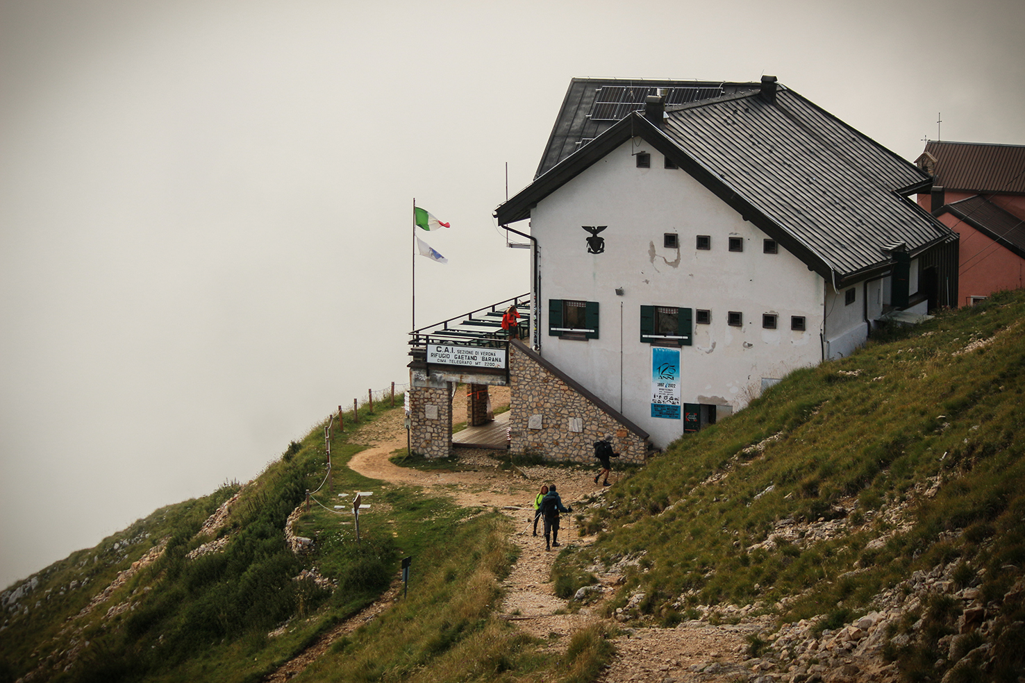
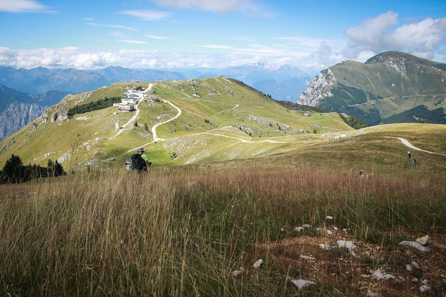
Bocchetta del Col Santo, Passo del Camino, Punta Sascaga, the trail winds continuously up and down, and by now, to conserve energy, we talk only as little as possible. Then, finally, a signpost indicates that the Telegrafo refuge is only half an hour away. We begin climbing again on rocky switchbacks, and once we’ve crested a pass, it appears like the most precious of gifts.
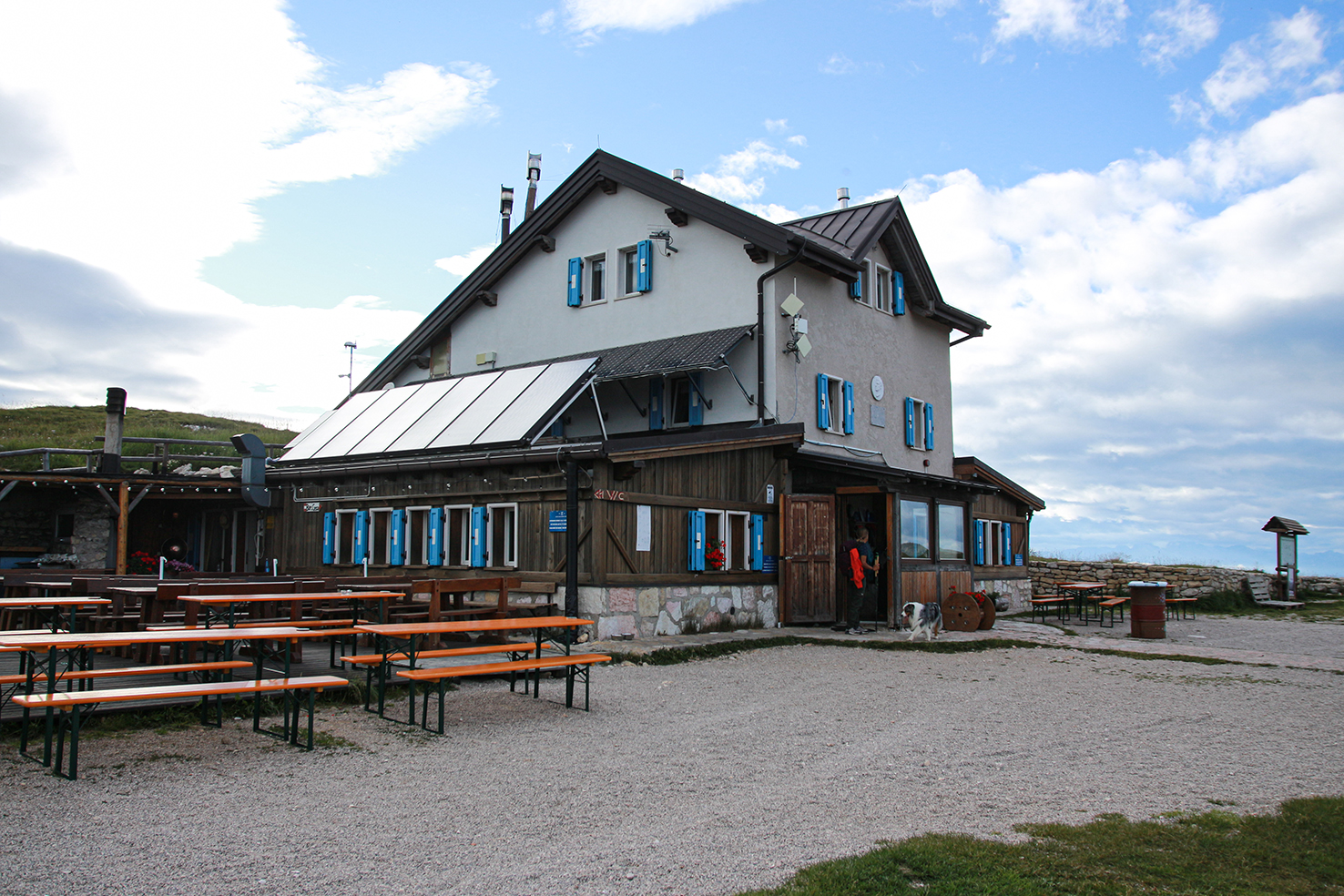
It’s 7:00 PM when we enter the dining room and introduce ourselves to the manager, Alessandro Tenca. Dinner is practically already on the table.
In the days leading up to our trek, we were already reading newspaper articles about the mountains as a tourist destination and their new visitors: unaccustomed to spartan services, with little respect for nature and its integrity, inclined to experience high altitudes as if they were an amusement park. Over the years, many mountain destinations have not only bowed to the demands of new visitors but have also offered increasingly high-end tourism, with services that have little to do with high mountains. Michelin-starred restaurants at 2,000 meters, “refuges” with single rooms and private bathrooms. All of this has only distorted the essence of the mountains and what we should seek in them: a wild environment to be preserved as much as possible in its natural integrity.
Alessandro himself explains what a refuge should be: a place of passage, a place of refreshment, with essential services, sustainable with respect to the resources available at high altitude (water, electricity, transport of materials). Italy, he tells us, “is the world’s leading nation in terms of the number of refuges (accommodation and catering facilities above a certain altitude), yet there is no clear regulation defining their requirements. On the contrary, a refuge is a structure that should be regulated according to the principle of providing the maximum service possible.” And so, while once upon a time, those frequenting these places understood the limitations of the services offered, today they demand elaborate menus and the comfort of four-star hotels.
To regulate the flow of visitors, Alessandro had the intuition three years ago (as the first CAI refuge) to adopt the concept of vertical high and low seasons. Saturday evenings are always high season, all of August is high season, and the rest of the week and year is low season, which corresponds to a 10% discount. Monte Baldo shouldn’t be considered solely for the Alta Via we’re currently hiking (objectively accessible between June 20th and September 20th). After a course in Trail Management, Alessandro aims to promote the area’s naturalistic features over time through a Grand Tour of biodiversity, with stages differentiated according to the season and the technical level.
“Mount Baldo can be considered the garden of Europe,” Alessandro continues. “From the lake’s 65-meter elevation to the summit’s 2,218-meter altitude, it offers a climate range from sub-Mediterranean to Scandinavian. Therefore, it’s a matter of implementing a project to promote the massif as a whole, highlighting its unique features in its entirety and diversifying its visitor base.”
First day card
- Route: from Prada Alta to the Telegrafo Refuge
- Distance: approximately 12 km
- Time with stops: 6.56 hours
- Ascent: 1.367 m
- Descent: 214 m
- QR CODE Mappa Suunto
Day Two. From the Telegrafo refuge to the Damiano Chiesa/Altissimo refuge.
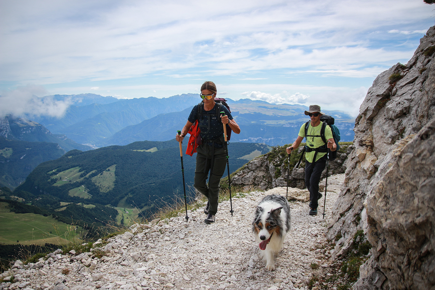
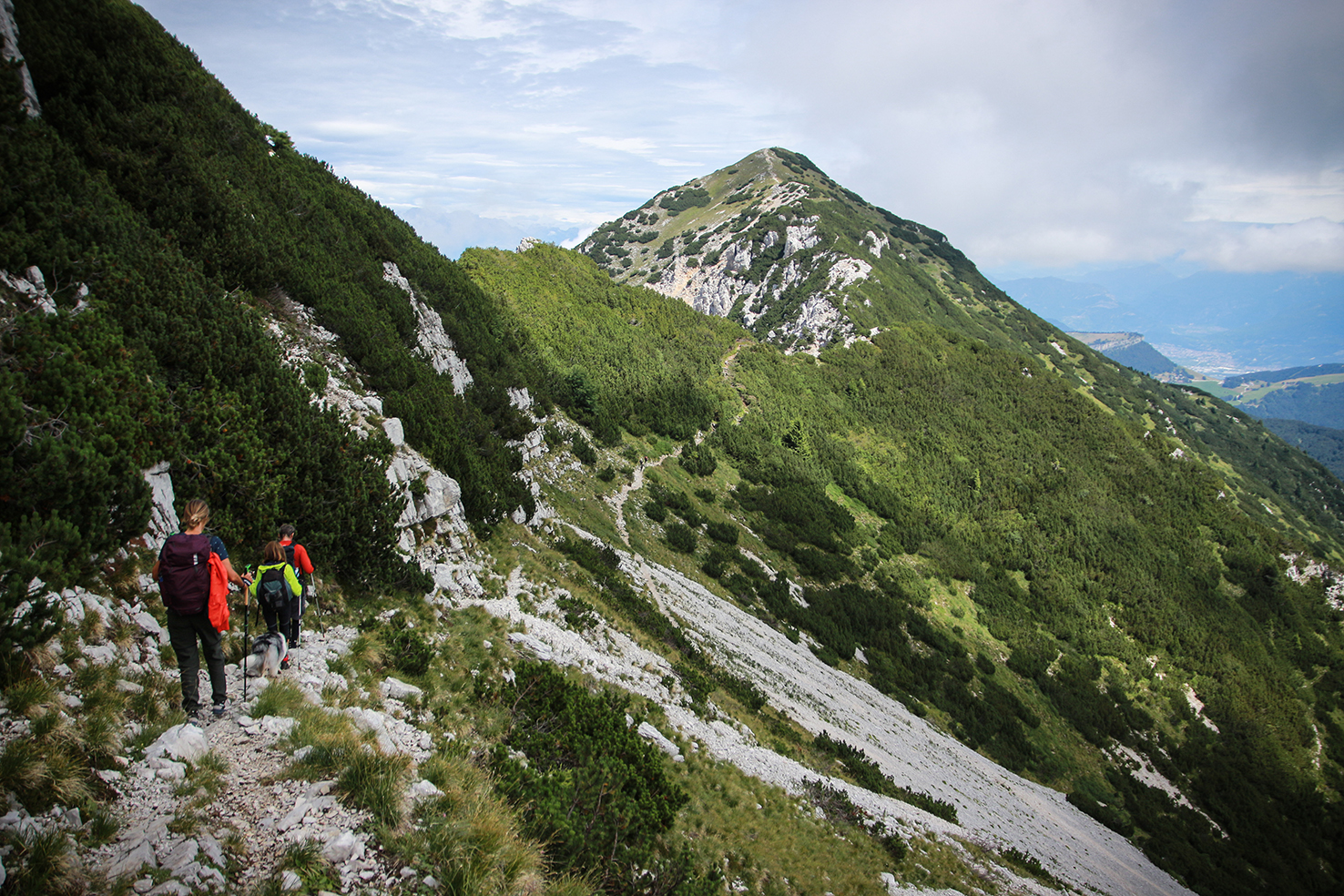
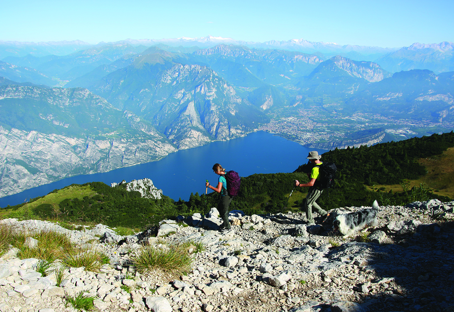
On Monday morning, we resume our journey; the hardest stage awaits us. As Alessandro had anticipated, the terrain here becomes more technical. We’re now deep in the high mountains, and from every peak we pass, we admire the valleys that open up almost to the lake: Cima Pettorina, Cima Prà della Baziva, Cima Valdritta, and Cima Longino.
It’s a constant up-and-down climb on a narrow path that winds through mountain pines and colorful flowers. Some sections require caution, and we sometimes have to hold onto Roger in the most exposed spots. Our gaze wanders between spectacular views of the blue Garda, the sudden sighting of a chamois just steps away, the scent of the scrub, and the beautiful plateau that since day one flanks Mount Baldo on the east side.
Having reached the penultimate and largest summit of the day, we stop for lunch.
Here at Cima delle Pozzette, at 2,132 meters, we find about ten people eating and sunbathing: they’ve all come from the north, from the Malcesine cable way station, which we can see below and a few kilometers away. The view here is spectacular, taking in Desenzano and Torbole in a single glance, with Campione del Garda 2.000 meters below us. Around 2:00 PM, we begin our descent, aiming to reach the cable car arrival point.
Here, nature changes again; we hike through waist-high meadows, flowers, and gentle slopes. It’s a more touristy mountain, and we hear people speaking every European language. When we reach the Baita dei Forti, we stop for a snack. I down a medium beer in two minutes and, exhausted, fall asleep at the terrace table. From here, we can see the stretch of trail ahead quite clearly, even though the refuge where we’ll sleep is hidden by the summit of Monte Altissimo. The break has restored my energy, but the sight of what lies ahead is bleak. We’ll have to descend significantly, before climbing back up to 2.060 meters.
We set off again, descending and crossing a forest before beginning to climb back up the paved provincial road, crossing the border between Veneto and Trentino. The shadows begin to lengthen as we slip back into the Monte Altissimo forest, and the 800-meter elevation gain takes the last of our energy, restored only by the view of the lake we see, almost at sunset.
We were hoping to reach the Damiano Chiesa all’Altissimo refuge in the late afternoon so we could relax, but it’s 7:30 pm again, just in time to give ourselves a quick wash, get changed, and enjoy a good dinner with friends.

Second day card
- Route: Telegrafo Refuge – Damiano Chiesa/Altissimo Refuge
- Distance: 16.22 km
- Time with stops: 8.58 hours
- Ascent: 1,040 m
- Descent: 1,133 m
- QR CODE Mappa Suunto
Day Three. From the Damiano Chiesa/Altissimo Refuge to Torbole.
On the morning of the third day we split up. Debora and Stefano will return from Malcesine and will do us the great favor of picking up the car left in Prada Alta. Do, Daniele, and Roger will continue on to Torbole, where we will take the bus to Garda and reunite.
The sun shines high in the sky as we head down the path. Once again, the view is spectacular: to the west, the lake, with Riva del Garda and Torbole in the foreground; to the north, the peaks of Alto Adige; and to the east, the Adige Valley. Below 1,500 meters, we slip back into the woods, which offer different vegetation depending on the altitude. I keep an eye on the altimeter; the kilometers traveled are making themselves felt, and with every hundred meters of elevation gain, I feel our goal getting closer. We pass the first houses, a small church where we ring the bell, and the cliffs of Nago, before emerging into the village and taking the paved road to Torbole.
We’re sitting in a pizzeria waiting for our fill. Roger is lying under the table, too tired to beg for pieces of Margherita pizza. Each of us is lost in our own thoughts. It will take us a few hours or a few days to rejoice in what we’ve accomplished.
But we did it, we managed to walk the back of that giant we see every day from our terrace at home, let’s toast to the feat.
Third day sheet
- Route: Damiano Chiesa/Altissimo Refuge – Torbole
- Distance: 10 km (to Nago)
- Time with stops: 4.37 hours (to Nago)
- Climb: 3 m
- Descent: 1.798 m (to Nago)
- QR CODE Mappa Suunto
- Total distance traveled: 38.82 km (up to Nago)
- Total altitude difference: 5.555 m (up to Nago)